What drives traffic
Traffic isn't growing. The school run is.
Every stretch of Boston Post Road carries less traffic today than it did in 1990, and on the busiest ones it has fallen sharply. More people take the train, work from home and shop online. But there is still one place a lot of people have to be at the same time every morning: school. That hasn't changed, and it's what drives the Post Road's traffic. On a morning with no school, a third of the traffic at one Post Road intersection disappeared.
Post Road traffic hasn't grown since 1990, and it fell after 2019
Mamaroneck is down a quarter since 2019 and Larchmont a quarter since 2014. The two Rye Neck segments have changed little.
Why daily traffic fell
About 8,800 Town of Mamaroneck workers drove to work in 1990. Today about 6,900 do, even though the town has more workers.
27%
work from home
Up from 7% in 2000. Since 2019, transit fell 11 points while working from home rose 19.
Fewer trips
to the store
E-commerce replaces shopping trips.
How Town of Mamaroneck workers get to work
Driving has fallen at every count since 1990. Before the pandemic the shift went to the train; since then, to working from home.
The exception: the school run
Schools are the biggest source of traffic and congestion in our area. Every student who is driven makes four car trips a day: drop-off, the drive home, pick-up, and the drive home again.
What we measured here
We measured it. In March 2024 we counted every vehicle through the Post Road intersection at Weaver Street and Hommocks Road, the road to Hommocks Middle School, from 8 to 9 am on two consecutive mornings. One was a normal school day. The other was a superintendent's day, when classes were canceled.
With no school, a third of the morning traffic disappeared
- School day, Thu Mar 7, 2024
- Superintendent's day, Wed Mar 6, 2024
The same morning, side by side
About eight minutes of morning traffic at the Post Road and Weaver Street / Hommocks Road, played at 4x speed, from the video volunteers counted.
The traffic that vanished was school traffic. Trips in and out of Hommocks Road fell by two-thirds or more, and even through traffic on the Post Road dropped by one car in seven. Ordinary turns to and from Weaver Street barely changed.
How our students get to school, school by school
Where parents say the route is unsafe, more kids are driven. At Mamaroneck Avenue, 64% of parents call the route unsafe and 73% of students are driven. At Chatsworth, 23% and 20%.
Ten schools, 6,000 students
Ten schools sit along Boston Post Road in Larchmont and Mamaroneck. They were a main reason Larchmont and both Mamaroneck governments asked NYSDOT to extend this work along the whole corridor.
Chatsworth Avenue
Central
Hommocks Middle
Mamaroneck High
Daniel Warren
F.E. Bellows
Rye Neck Middle
Rye Neck High
FASNY Manor
FASNY Harbor
Why don't more kids walk or bike? Two in three parents say it's too dangerous.
The national picture
The same shift has happened across the country, over two generations.
Nationally, the walk to school became a drive
In 1969, four times as many students walked or biked to school as were driven. By 2009 it had reversed.
- 1969
- 2009
Built for walking
Four of our six district schools were built between 1902 and 1925, in the middle of the neighborhoods they serve. Children were expected to walk or bike to them, and two still have no parking lot at all. Central, built in 1965, has a small lot, and the Hommocks lot wasn't enlarged when that school expanded in the 1990s.
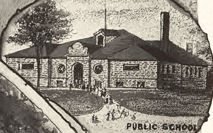
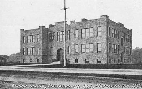
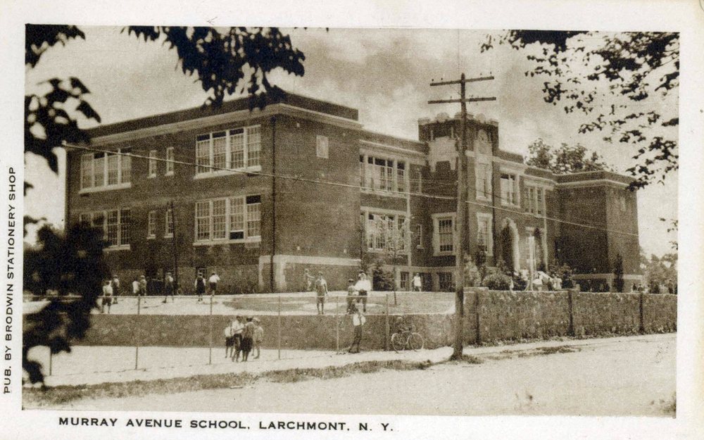
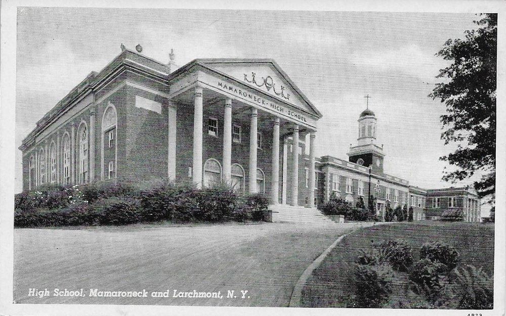
The streets around these schools can't absorb every child arriving by car. The road's hardest minutes are the school runs, and every child who can safely walk or bike is one fewer car in that line. Safer walking and biking is exactly what this project builds.
Sources
- NYSDOT traffic counts, Boston Post Road, 1990–2025Average annual daily traffic for four segments. Counts run from 1979; the chart shows 1990 onward.NYSDOT Traffic Data Viewer
- US Census Bureau, Means of Transportation to Work, Town of Mamaroneck1990: CPH-5-34, Table 5. 2000: Summary File 3, P030. 2006–10, 2015–19, 2020–24: ACS 5-year, B08301.1990 · 2000 · 2010 · 2019 · 2024
- Superintendent's day traffic count, Boston Post Road at Weaver St / Hommocks RdEvery vehicle, by movement, 8–9 am on Wednesday March 6, 2024 (no classes) and Thursday March 7, 2024 (school day), counted from video by Safe Routes to School volunteers.
- National Center for Safe Routes to School, “How Children Get to School: School Travel Patterns from 1969 to 2009” (2011)From the 1969 NPTS and 2009 NHTS: usual travel mode to school for K–8 students, as reported by parents.pedbikeinfo.org
- FHWA NHTS Brief: Children's Travel to School (2019)2017 NHTS, children 5–17: 54.2% usually driven, 33.2% school bus, 10.4% walked or biked.nhts.ornl.gov
- Mamaroneck Union Free School District, school historiesConstruction and addition years for each school, from the district's history page. Parking notes are Safe Routes to School's own observations.mamkschools.org
- Municipal resolutions, 2024Resolutions asking NYSDOT to bring Complete Streets to the full length of Route 1 (PIN 8473.15), each passed unanimously: Village of Larchmont, Village of Mamaroneck (January 8, 2024 agenda) and Town of Mamaroneck (January 2024).
- Mamaroneck and Rye Neck Safe Routes to School parent survey, 20251,024 responses, one per child, from Chatsworth, Central, Murray, Mamaroneck Avenue, Hommocks and Mamaroneck High School; 18.5% of enrolled students overall.