Process
Requested locally, paid for by the state
Our municipalities asked for this project. NYSDOT designed it, and state and federal money pays for it. The design isn't final, and there is still time to weigh in.
Where it came from
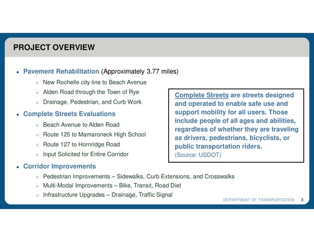
When NYSDOT planned to repave Boston Post Road, it noticed that downtown Larchmont, from Beach to Alden, has an unusually high number of crashes for its traffic. So it added a Complete Streets safety component to the repaving.
Public outreach
NYSDOT lists the project as "In Development." It has shown alternatives at two public open houses and keeps refining the design based on engineering and public input.
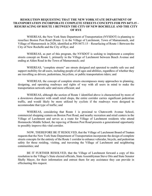
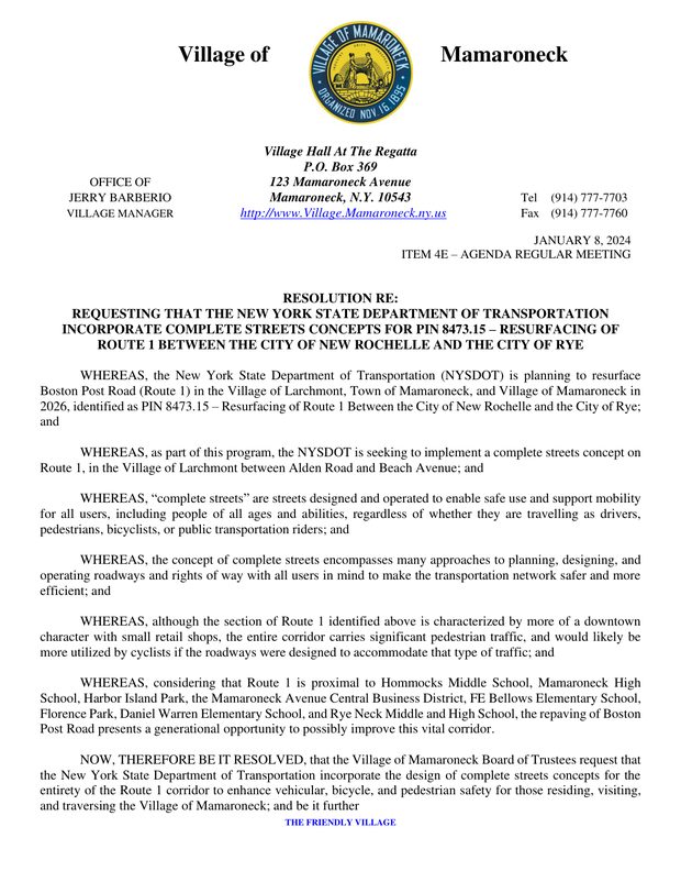
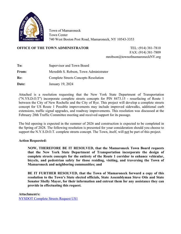
- 2024Larchmont, the Village of Mamaroneck and the Town of Mamaroneck each pass a resolution asking NYSDOT to extend Complete Streets the full length of Route 1. A big reason was the ten schools along the route, with more than 6,000 students.
- July 2024First stakeholder meeting with the municipalities and the schools, on July 31.
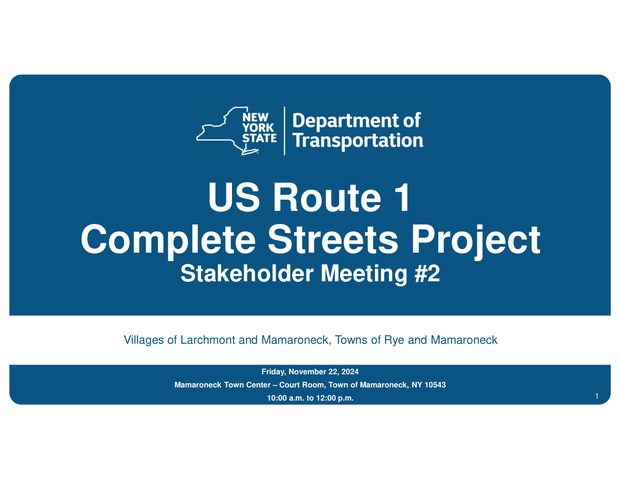
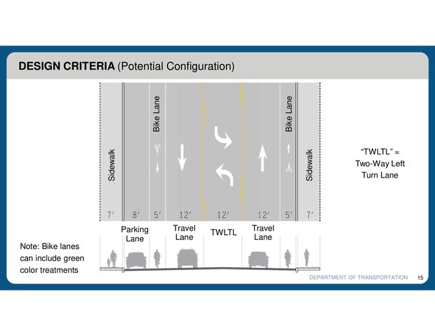
- November 2024Second stakeholder meeting. A road diet is on the table from the start: NYSDOT’s own slides list it among the corridor improvements, and set out the lane widths a three-lane design would use.
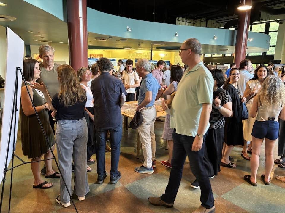
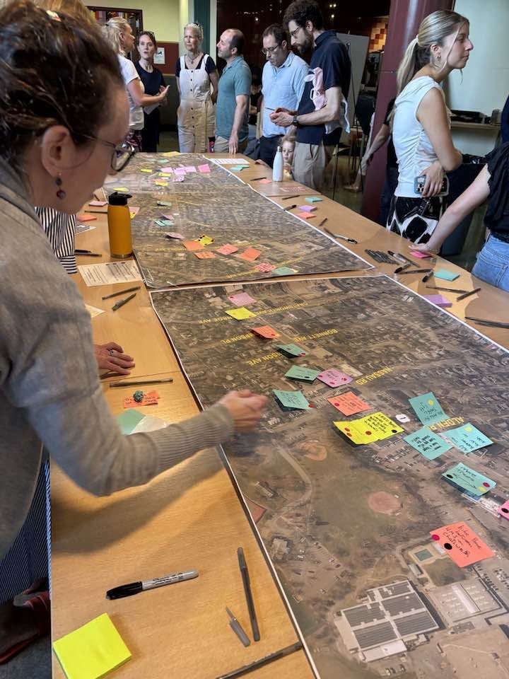
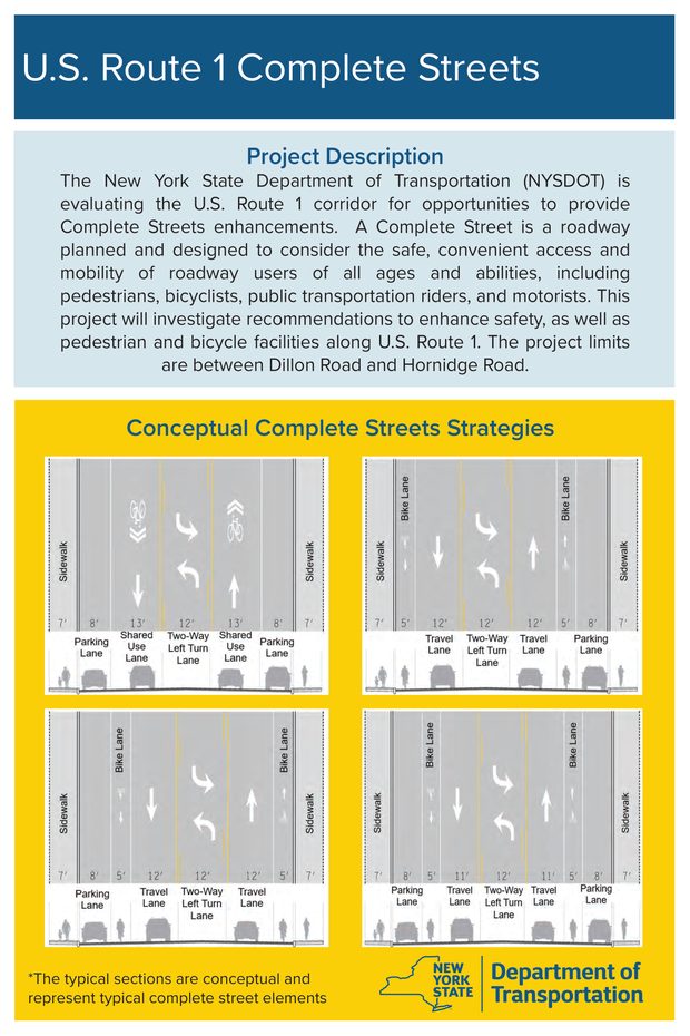
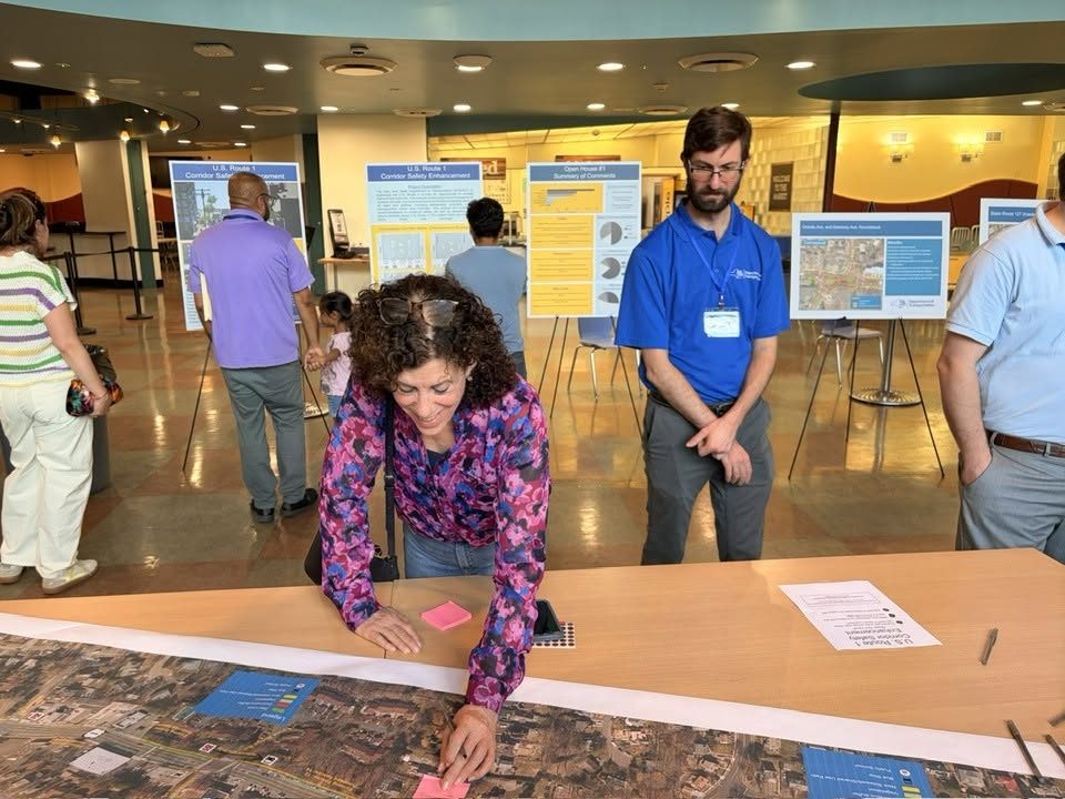
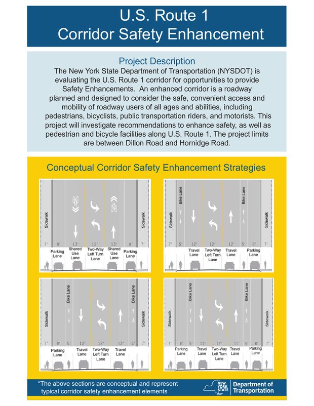
- June 2025First public open house. NYSDOT’s boards showed four conceptual cross-sections for the corridor, three of them with bike lanes and a two-way left-turn lane. People could talk to the project team face to face and write directly on roll plots of their own streets.
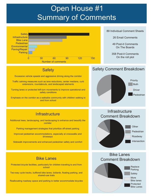
NYSDOT counted it all up and reported back at the next open house: 89 comment sheets, 26 emails, 49 post-its on the boards and 358 on the roll plots. Safety came first, ahead of infrastructure, bike lanes and everything else.
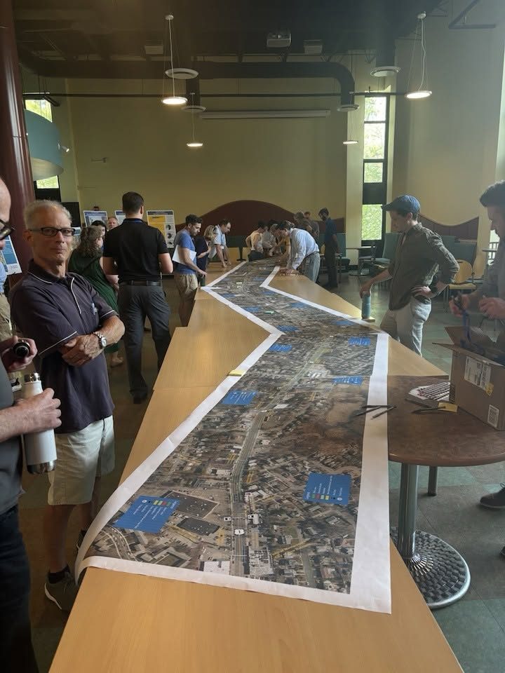
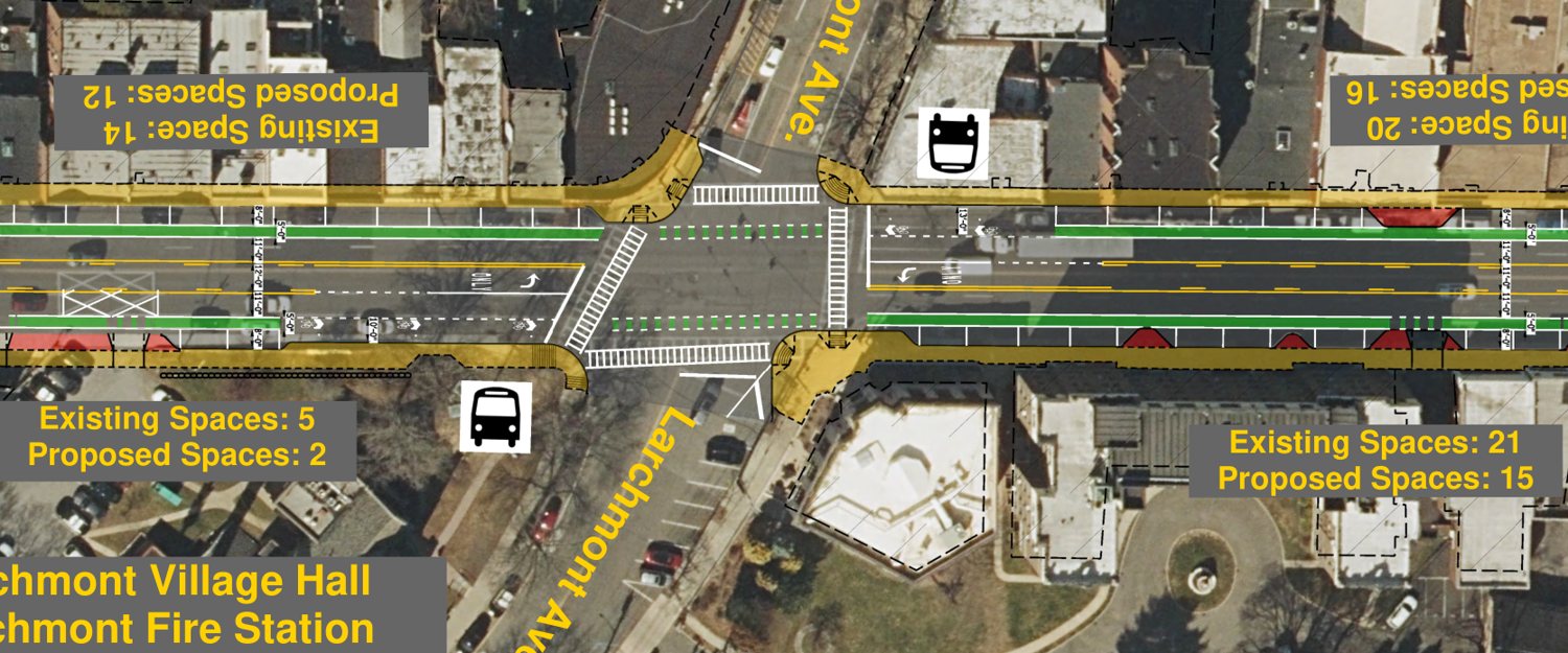
- April 2026Second open house, and the plan is revealed: roll plots drawn over aerial photographs, showing the proposed design block by block along the whole corridor. Residents could walk the length of their own street on the table and give the project team direct feedback on what NYSDOT was proposing.
The four roll plots cover the corridor end to end: Roll plot 1 · Roll plot 2 · Roll plot 3 · Roll plot 4. NYSDOT also posts the open house boards and the rest of the project documents on its project page.
- Fall 2026Third public meeting expected
- 2028–29Construction expected to start
The work behind the plan
NYSDOT has spent the two years since, and hundreds of thousands of dollars, measuring this road. From its own account of the work:
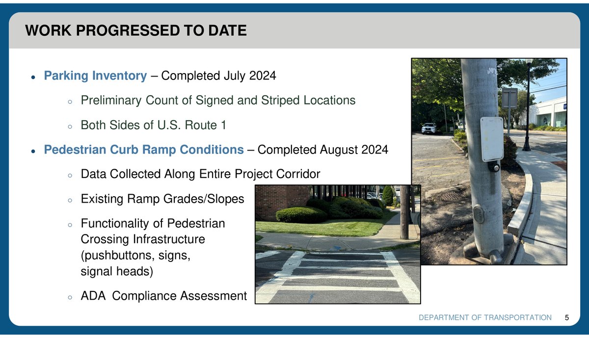
- Parking inventory, completed July 2024. A count of every signed and striped space, on both sides of Route 1.
- Pedestrian curb ramp conditions, completed August 2024. Ramp grades and slopes along the entire corridor, the functionality of every pushbutton, sign and signal head, and an ADA compliance assessment.
- Pavement evaluation, collected September 2024. From the New Rochelle city line to the Town of Rye boundary: reflective cracks, joint separation, longitudinal and edge cracking, raveling, and shoving at intersections.
- Ground and aerial survey. A detailed ground survey with highway boundary identification and utility mapping from Beach Avenue to Alden Road, finished October 2024, plus control points painted for an aerial mapping flight.
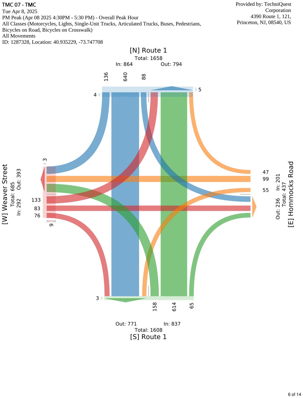
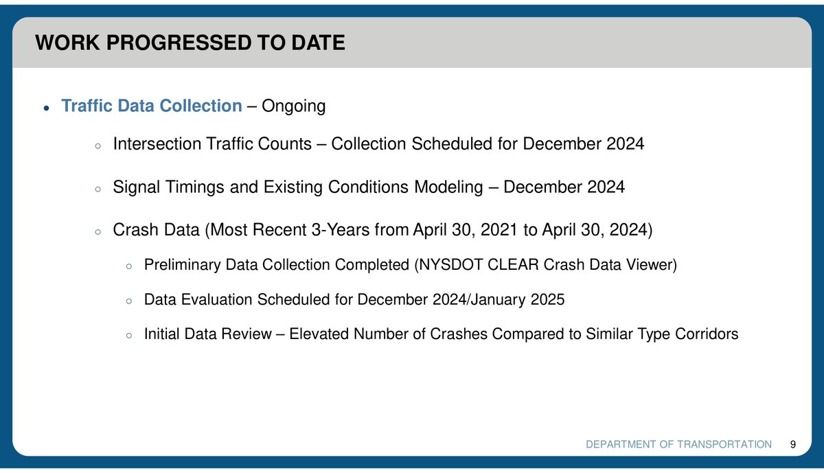
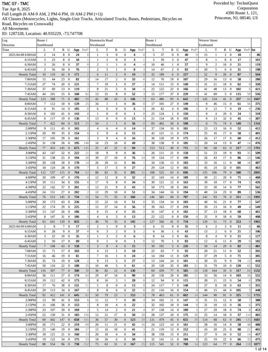
- Traffic counts and modeling. Turning movement counts at 20 intersections, signal timings, and a model of existing conditions for the full stretch.
- Crash data. Three years of records, from NYSDOT’s own crash data viewer. The initial review: an “elevated number of crashes compared to similar type corridors.”
- Design Approval Document. Project need, purpose and objectives; alternatives development and analysis; design standards and criteria; social, economic and environmental conditions; threatened and endangered species and cultural resources; construction impacts.
What came back is a comprehensive Complete Streets redesign built to modern safety standards, with the design work paid for by the state.
What the traffic model is for
Those counts are not collected for their own sake. They feed a model, and NYSDOT’s schedule put the traffic modeling and capacity analysis in December 2024. A capacity analysis is a narrow, well-defined piece of engineering. For every signal on the corridor it asks three questions:
Does the intersection clear?
Whether the green time on each approach is long enough to let through the cars waiting on it, cycle after cycle.
How far back does the line go?
Whether a queue at one light reaches back to the light behind it. That is what turns a slow intersection into a blocked corridor.
How long is the wait?
The average seconds of delay a driver spends at the intersection. That number is what gets graded as Level of Service, A through F.
The model runs the same arithmetic twice, once on the road as it is today and once on the design being proposed, so the two can be compared intersection by intersection. It is the step that answers whether a lane can come out without the traffic backing up — and it happens before a design is put in front of the public, not after.
Who pays
The project is PIN 847315 in the regional transportation plan, where every dollar programmed for it is listed by phase, by year and by funding source.
$20.9M
programmed in total
Federal and New York State transportation funds, from preliminary design through construction.
$0
local contribution
Not one line in the funding table is local money. NYSDOT is running and paying for the project.
10–20%
the usual local match
What most grant-funded road projects ask a town or village to put in. This one asks for nothing.
- $16,000,000 for construction, programmed for federal fiscal year 2028.
- $2,400,000 for construction inspection, the same year.
- $2,250,000 for design — $1,250,000 of preliminary design already spent, and $1,000,000 of detailed design in 2026.
- $220,000 for right of way.
The funding sources are worth reading too. Alongside the National Highway Performance Program and New York’s State Dedicated Fund, $4,140,000 of the construction money is federal Highway Safety Improvement Program funding — money that exists to reduce deaths and serious injuries. The plan lists the project’s type as safety, and records that the state certified it as approved by the Regional Safety Evaluation Engineer and signed off by the Regional Traffic Engineer.
The state is rebuilding and restriping the road either way. Doing it as a road diet costs Larchmont and Mamaroneck nothing extra and fixes a known safety problem while the crews are already there.
How to weigh in
You can also sign the petition and email your officials. NYSDOT's plans and boards are on its project page.
Sources
- Municipal resolutions, 2024Resolutions asking NYSDOT to bring Complete Streets to the full length of Route 1 (PIN 8473.15): Village of Larchmont (March 4, 2024), Village of Mamaroneck (January 8, 2024 agenda) and Town of Mamaroneck (January 2024).
- NYSDOT, US Route 1 Complete Streets Project, Stakeholder Meeting #2, November 22, 2024Held at the Mamaroneck Town Center with the Villages of Larchmont and Mamaroneck and the Towns of Rye and Mamaroneck. Corridor improvements include “Multi-Modal Improvements – Bike, Transit, Road Diet”; the design criteria slides set out the lane, turn-lane and bike-lane widths. The schedule slide dates the first stakeholder meeting to July 31, 2024.Slides (PDF)
- NYSDOT, US Route 1 Complete Streets, first public workshop boards, 2025Project description and four conceptual Complete Streets cross-sections, three of them with bike lanes and a two-way left-turn lane.Boards (PDF)
- NYSDOT, US Route 1 Corridor Safety Enhancement, second open house boards and roll plots, April 2026The boards and the roll plots showing the proposed design along the corridor. Board 3 summarises the comments from the first open house: 89 comment sheets, 26 emails, 49 post-its on the boards and 358 on the roll plots, with safety the largest category by a wide margin. The full roll plots are on NYSDOT’s project page.Boards (PDF) · Roll plots
- NYMTC, Plan 2055 / TIP 2026–2030, project MHSWC12075C (PIN 847315), “Resurface US Route 1”Lead agency NYSDOT, Westchester County, project type Safety. Total programmed $20,870,000: preliminary design $1,250,000 and right-of-way incidentals $20,000 in prior years, detailed design $1,000,000 in FY2026, right-of-way acquisition $200,000 and construction and inspection $18,400,000 in FY2028. Funding sources are HSIP and NHPP (federal) and the State Dedicated Fund; none is local. The description covers US Route 1 from the New Rochelle city line to the City of Rye, in the Towns of Mamaroneck and Rye and the Villages of Larchmont and Mamaroneck.NYMTC project record
- NYSDOT, Westchester County US Route 1 Complete StreetsProject documents, boards, budget and status.projectdocs.dot.ny.gov