Boston Post Road · Larchmont & Mamaroneck
Boston Post Road is dangerous. There's a proven fix.
Anyone who drives, walks or bikes the Post Road knows it isn't safe. In the past 11 years, five people have been killed on it, and 44 pedestrians and 46 cyclists have been hit. Many parents of the 6,000 students at its ten schools won't let their kids walk or bike, so they drive, and the road clogs at drop-off. Our three municipalities unanimously asked NYSDOT to fix it. After two years of study, NYSDOT has proposed a Complete Streets upgrade that is safer and keeps traffic moving. It's a proven design, already working in many places, including nearby in Ossining, Rye and Fairfield, Connecticut.
19–47%
fewer crashes
The Federal Highway Administration lists four-to-three road diets as a proven safety countermeasure.
SafetySame flow
or better, at every signal but one
NYSDOT counted turns at every signal and modeled the corridor. The one exception, Orienta and Delancey, already has a problem and is getting its own fix.
Traffic$0
from local taxpayers
The $19.5 million project is paid for with federal and state money. Most grant-funded projects need a 10–20% local match. This one doesn't.
ProcessFive people killed in three crashes since 2017
All on one 1.5-mile stretch of Boston Post Road.


People on foot and on bikes hit on Boston Post Road, 2015–2025:
46
cyclists hit
44
pedestrians hit
78
people injured
8
seriously injured
Where people on foot and on bikes get hit
Every pedestrian and bicycle crash in Larchmont and Mamaroneck, 2015–2025. Brighter means more crashes; note the clusters around the schools and the train stations.
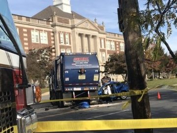
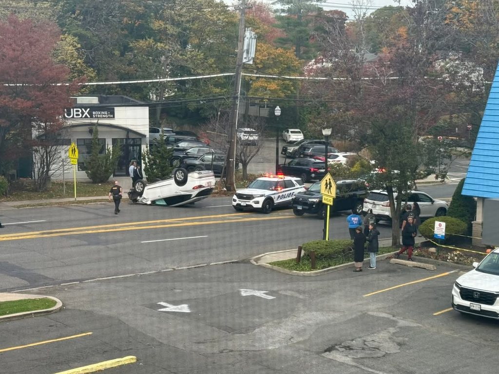
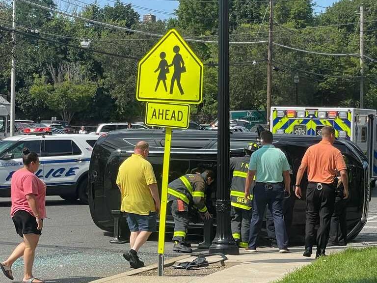
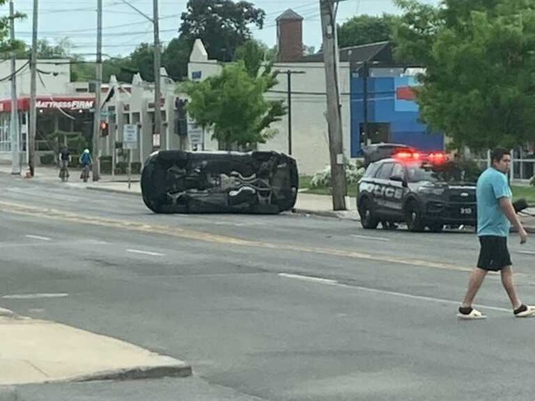
For every fatal crash there are many more that could have been. Here are three recent rollover crashes, in daylight, in good weather, steps from school.
Three things you can do
Sign the petition
Tell NYSDOT and our local leaders you support a safer Boston Post Road.
If you have a partner or spouse, ask them to sign too. Signature counts are what decision-makers look at, so every name adds up.
Email your officials
We've drafted a short letter. Add one sentence of your own at the top. A personal line counts for far more than a form letter.
It goes to the Town of Mamaroneck board, both village boards, State Senator Shelley Mayer, Assembly Member Steven Otis, County Legislator Anant Nambiar and NYSDOT’s design project manager for the corridor, Christopher Hann. Rep. George Latimer takes messages through his website.
Read the letter
To:
Come to the next public meeting
DOT's plan is based on extensive work
In early 2024 the Village of Larchmont, the Village of Mamaroneck and the Town of Mamaroneck each asked NYSDOT to make Boston Post Road safer as part of its repaving project.
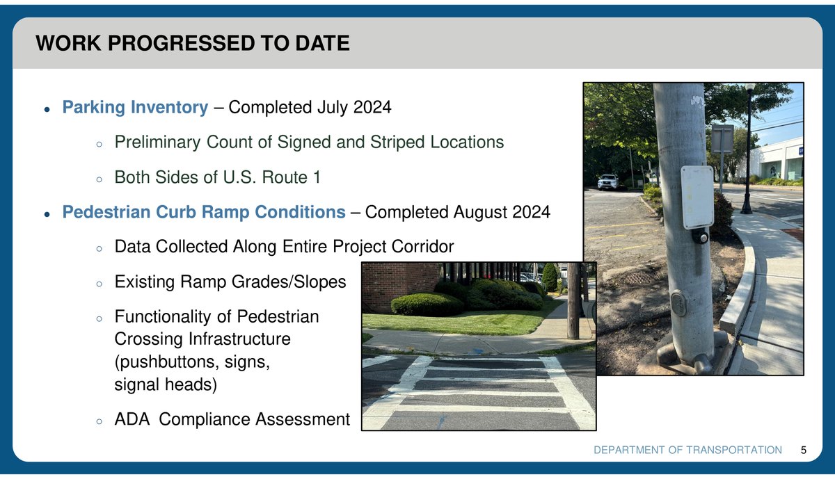
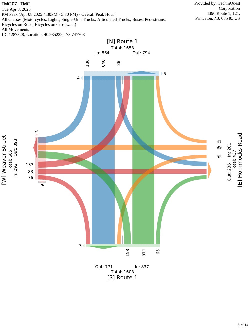
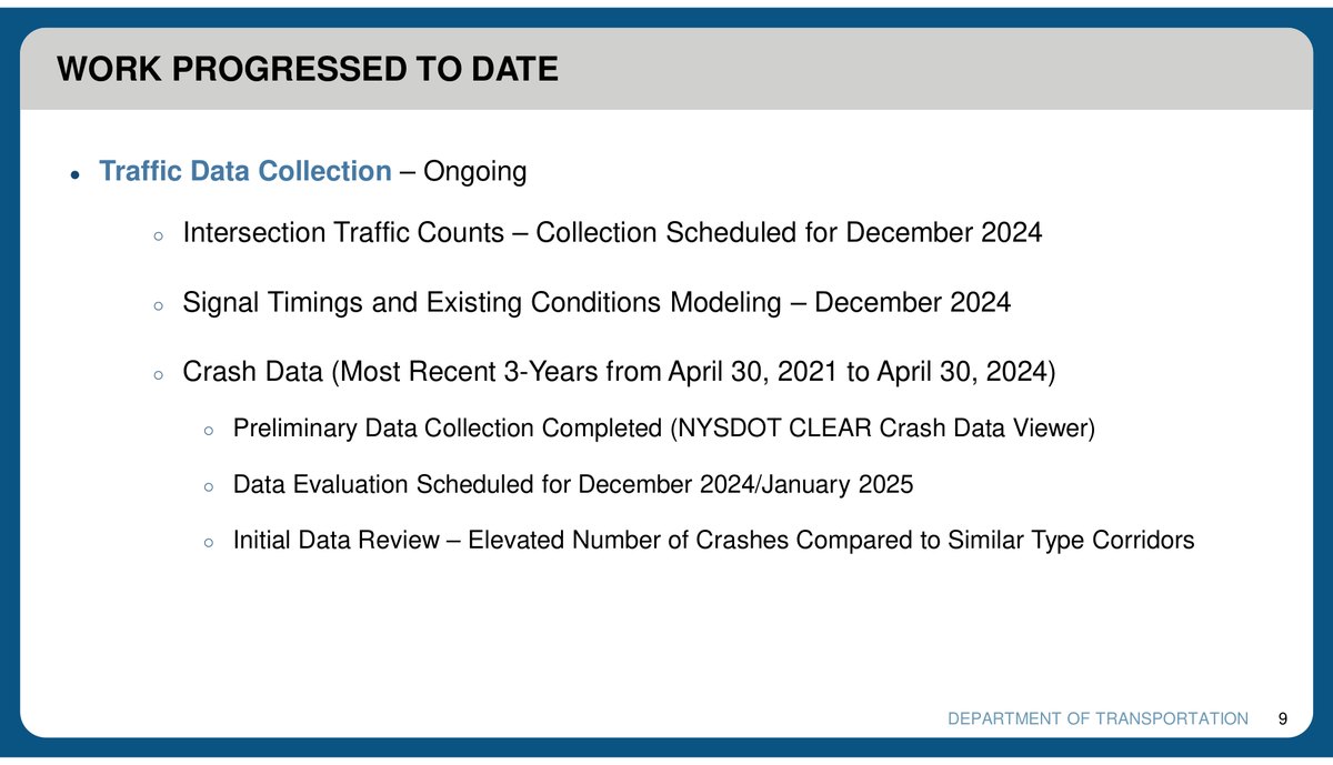
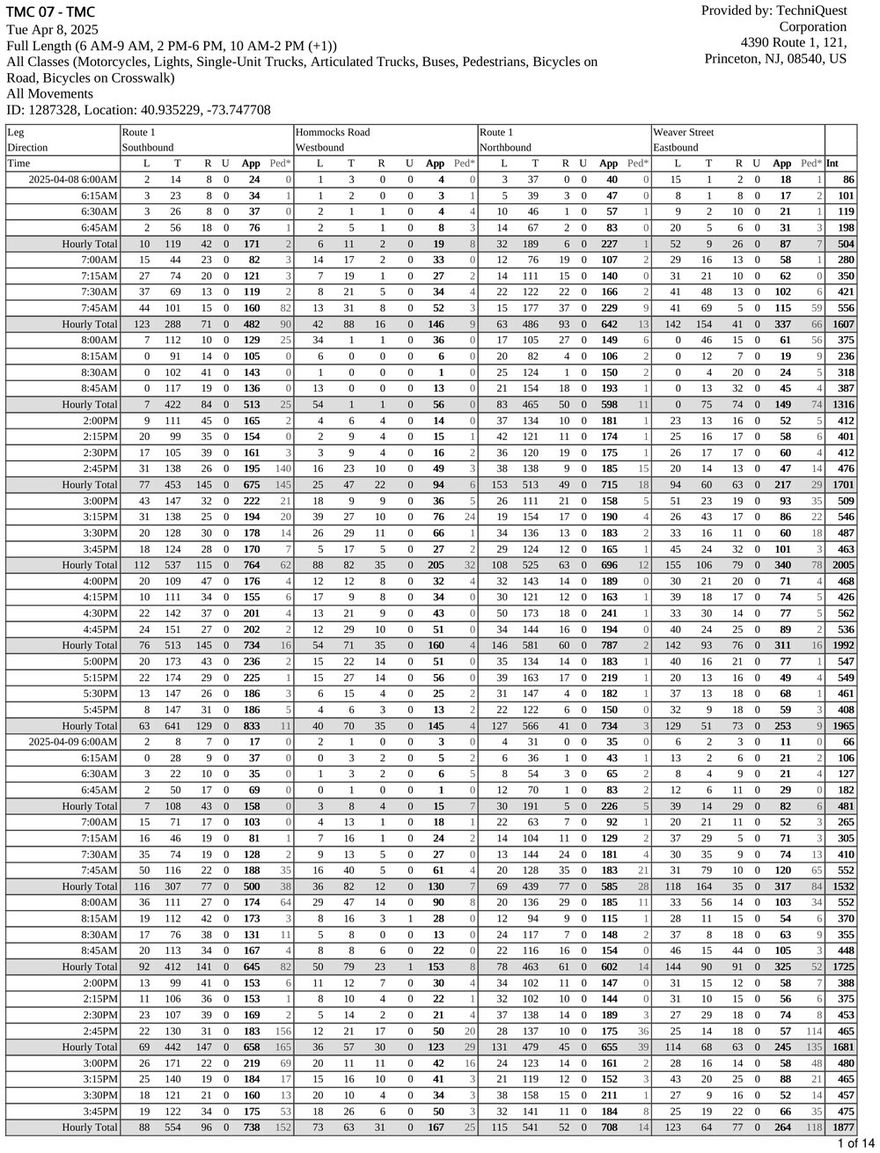
NYSDOT has spent the two years since, and hundreds of thousands of dollars, collecting, analyzing and modeling the corridor: turning counts at 20 intersections and a traffic model of the full stretch, a parking inventory, an ADA assessment of every curb ramp and pedestrian signal, a pavement evaluation from the New Rochelle line to the Rye town line, a ground and aerial survey, and three years of crash records.
What came back is a comprehensive Complete Streets redesign incorporating modern safety standards. And because the current layout is so poor, the redesign improves traffic flow at the same time, which makes this a genuine win-win-win: better safety, better traffic flow, and no cost to the local taxpayer, because the project is state funded.
NYSDOT has deep experience with Complete Streets and road diets, and it has done the data collection and modeling to back this one. It is also a conservative, car-oriented agency: it would not put forward a design it expected to snarl traffic. Its analysis has the plan maintaining or improving level of service — the standard measure of delay — at every intersection except Orienta Avenue, which is getting improvements of its own.
How three lanes can beat four
A road diet isn't taking away a travel lane; it's moving the turning cars out of your way
Boston Post Road's lanes are about 9.5 feet wide, well under the 11-foot standard. On a four-lane road, every driver who stops to turn left blocks a lane. The cars behind either stop too or swerve into the next lane.
A center turn lane gives that driver somewhere to wait. Through traffic keeps moving, and the crashes that come from sudden braking and lane-swerving mostly go away.
Boston Post Road adapts to fit the times
Today's four lanes date from its time as the main route to Boston. They don't fit its job now: a local road that kids use to get to school.
- 1670sHorseback and stagecoach
Colonial riders began carrying mail between New York and Boston in 1673. The coastal route through our towns, the Lower Post Road, carried horses, carts and stagecoaches for two centuries.
- 1901–1927Electric trolleys
Streetcars of the New York and Stamford Railway ran through Larchmont and Mamaroneck, from New Rochelle to Stamford. Buses replaced them by 1927.
- 1926US Route 1
The Post Road became part of US Route 1, the main motor road between New York and Boston. By the 1950s it carried 25,000 cars and “gargantuan interstate trucks” a day through New Rochelle.
- 1958I-95 opens
The New England Thruway opened a short distance away, built to take that load off the Post Road. Today I-95 and the Hutchinson River Parkway carry the long-distance traffic.
- TodayA local street
The Post Road carries local trips now: to school, to the train, to the shops. Daily traffic is down to about 15,000 in Mamaroneck and 10,000 in Larchmont. It still has the four lanes of a highway.
Interstates and parkways connect New York and Boston now. Let's make Boston Post Road a proper local street, one where kids can get to school safely.
Where things stand
The design isn't final. NYSDOT calls the project "In Development" and is still taking public input.
- 2024Larchmont, the Village of Mamaroneck and the Town of Mamaroneck each ask NYSDOT, unanimously, to extend Complete Streets the full length of Route 1
- Jul 2024First stakeholder meeting with the municipalities and schools; a road diet is on the table from the start
- June 2025First public open house
- April 2026Second open house; NYSDOT presents the current design
- Fall 2026Third public meeting expected
- 2028–29Construction expected to start
Have a question?
Won't fewer lanes cause gridlock?
NYSDOT's model says no. Our own simulation shows why.
Is the Post Road really that dangerous?
90 pedestrians and cyclists hit in eleven years, clustered around the schools.
What happens to parking?
Most of it stays.
Isn't traffic getting worse?
Not on the Post Road. Daily volumes are at or near their lowest in 45 years.
Who we are: Safe Routes to School
Safe Routes to School is a federal, state and local effort to help children walk and bicycle to school safely. The Mamaroneck and Rye Neck Safe Routes to School committees are volunteer groups of parents. They work with school PTAs and administrators, local police, fire departments and municipal governments, and county, state and federal officials to coordinate safety efforts.
Some of what we do:
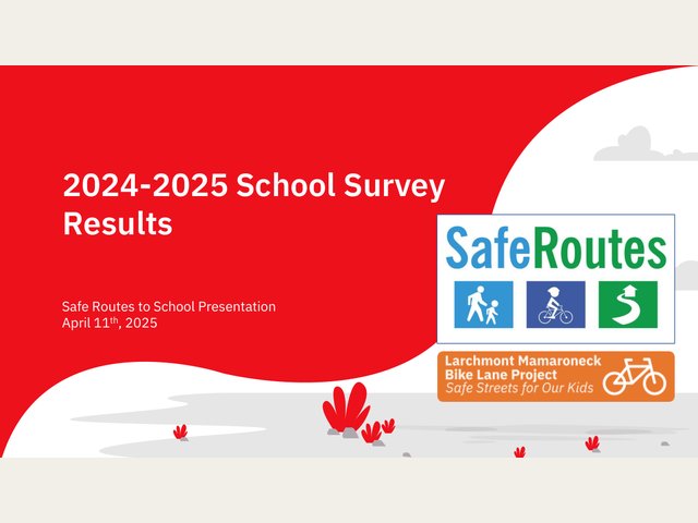
Parent surveys
A survey every year on how children get to school and what keeps families from walking or biking. It informs long-term safety plans and the school-travel numbers on this site. 2024–25 results (PDF)
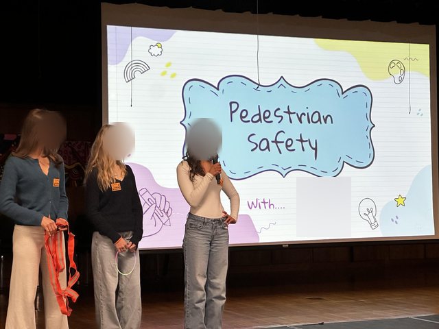
Pedestrian safety education
Pedestrian safety talks for kindergarten, 1st, 5th and 6th grades.
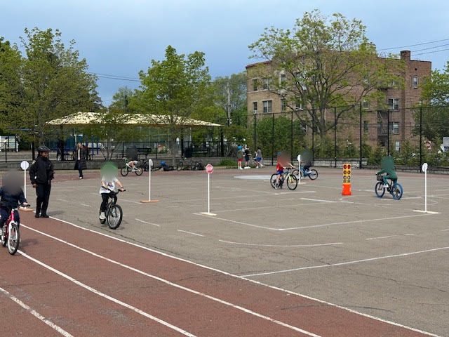
Bike rallies
A spring kickoff to the riding season, with a practice course and bike safety checks and repairs.
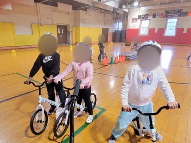
Learn to Bike in PE
An eight-session learn-to-bike program in kindergarten PE over the winter.
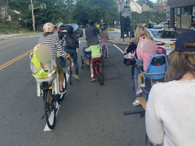
Bike buses
A weekly Friday ride to school that teaches kids road safety along the way.
Sources
- FHWA, Road Diet Informational Guide, ch. 2Four-to-three conversions: 19–47% fewer total crashes.highways.dot.gov
- NYSDOT traffic analysis, US-1 Complete StreetsTurn counts at every signalized intersection and a corridor model, presented at the 2025 and 2026 open houses and described to us by NYSDOT staff.NYSDOT project documents
- NYSDOT, Westchester County US Route 1 Complete StreetsProject documents, boards and status.projectdocs.dot.ny.gov
- Municipal resolutions, 2024Resolutions asking NYSDOT to bring Complete Streets to the full length of Route 1 (PIN 8473.15), each passed unanimously: Village of Larchmont, Village of Mamaroneck (January 8, 2024 agenda) and Town of Mamaroneck (January 2024).
- NYSDOT crash records, 2015–2025, mapped by Mamaroneck and Rye Neck Safe Routes to SchoolPedestrian and bicycle crashes in Larchmont and Mamaroneck, including the 46 cyclists and 44 pedestrians hit on Boston Post Road. Eleven years rather than ten, because 2020, with its pandemic lockdowns, wasn't a normal year.Crash map
- Fatal crashes on Boston Post Road, 2017–2023Three crashes, five deaths, on a 1.5-mile stretch. Compiled by Mamaroneck and Rye Neck Safe Routes to School.
- NYSDOT traffic counts, Boston Post RoadAverage annual daily traffic: 14,958 in Mamaroneck and 10,104 in Larchmont at the most recent count (2024).The 45-year trend
- Boston Post RoadThe first post rider left New York for Boston in January 1673.Wikipedia
- New York and Stamford RailwayElectric streetcars from 1901; all lines replaced by buses by the end of 1927.Wikipedia
- U.S. Route 1 in New YorkDesignated in 1926, first signed in New York in 1927.Wikipedia
- “Thruway to Cut a Painful Gash Across Heart of New Rochelle,” The New York Times, March 1, 1955New Rochelle's mayor said the Thruway was essential to relieve the Boston Post Road of a daily load of 25,000 cars and trucks.nytimes.com
- Interstate 95 in New YorkThe New England Thruway opened October 15, 1958.AARoads
- NYSDOT, Detailed Advertisement, Request for Qualifications: Design Services for Resurfacing of Route 1 from Beach Ave. to Alden Rd., Village of LarchmontContract D041162, PIN 0473.15.101, published September 21, 2023. Consultant start May 16, 2024; estimated contract duration 24 months; estimated highway construction cost $16,000,000. The scope names “consideration of a road diet.”Advertisement (PDF)
- NYSDOT, US Route 1 Complete Streets Project, Stakeholder Meeting #2, November 22, 2024“Work progressed to date”: parking inventory (July 2024), pedestrian curb ramp conditions and ADA assessment (August 2024), pavement evaluation (September 2024), ground and aerial survey, design approval document, crash data and traffic data collection. Slides 5 and 9 are shown above.Slides (PDF) · NYSDOT project documents
- Turning movement counts for NYSDOT, US Route 1, April 2025Twenty intersections along the corridor, counted by TechniQuest Corporation, mostly on Tuesday April 8, 2025. Every movement, by vehicle class, including pedestrians and bicycles. The pages above are from the count at Route 1, Hommocks Road and Weaver Street.